
Start South San Francisco Street Directory
The address workflow is parcel first, people second. San Mateo County Property Maps can turn a South San Francisco street number into an APN, map reference, or recorded parcel reference. The APN gives recorder, permit, and tax channels a durable key. A name search is weaker because the recorder is organized around grantors and grantees, not dependable street addresses.
Walk one address at a time and date every result. The question may concern title, a past occupant, a permit applicant, or family history. A parcel map shows land, a deed names parties, and a historical directory lists a person for its publication period.
- Enter the address in Property Maps and save the APN, map link, and recorded-map references.
- Open the parcel in GIS and note adjoining APNs, lot lines, subdivision, and map clues.
- Search ACRE's Grantor-Grantee Index by both party roles, using the parcel's legal description.
- Check city permits for dated applicants, contractors, work, and inspections.
- Use election channels and local directories only for their approved purpose and period.
South San Francisco Street Directory Records
A street-by-street trail combines address-keyed records with sources that need a parcel or date. The table separates what each record can show from what it cannot prove.
| Source | What It Shows | Street Method | Limits |
|---|---|---|---|
| Property Maps and GIS | Parcel geometry, APN, map references, adjoining lots | Search addresses or pan the block | Does not name every occupant |
| Assessor and tax channels | Situs, assessment account, mailing destination where disclosable | Query parcels by APN | Mailing address is not occupancy proof |
| Recorder index and deed | Grantors, grantees, legal description, transfer dates | Convert address to APN, then search parties | Not a daily resident roll |
| City permits and planning | Applicant, contractor, project, work, inspections | Search address or request legacy files | Applicant is not always an occupant |
| Directories and voter data | Historical names or authorized registration data | Use street sections or approved purpose | Coverage, privacy, and dates vary |
The APN bridges the first four rows. The street name locates a parcel, but the legal description keeps a deed chain attached when an address changes or units share one number. Record the source, date, and limit beside each name.
Search South San Francisco Street Property Maps
The San Mateo County Assessor Maps instructions identify two useful starting modes: Find parcels by ADDRESS and Find parcels by APN. The address result links to the Assessor Map and All Available Recorded Maps. The APN mode is better when an earlier deed, permit, or tax record already supplies the parcel number.
Property Maps is a real search tool, not an unrestricted owner-name directory. Save the match before moving to a title question. A map can show parcel boundaries, lot identifiers, adjoining parcels, and map references; it does not establish who was inside the building. Free map downloads and paid official prints are separate access choices.
The linked county instructions show the address-to-parcel path.
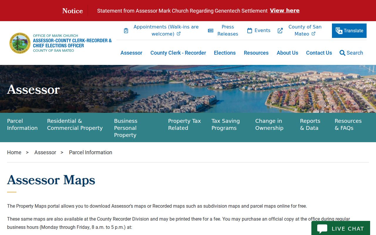
The saved APN and map references can anchor a deed, permit, or adjacent-parcel review.
| Find parcels by ADDRESS | Enter a street address and select Search; open Assessor Map or All Available Recorded Maps. |
|---|---|
| Find parcels by APN | Enter the assessor parcel number for an exact match. |
| Assessor Maps | Use the property-map book and page fields, then download the map name. |
| Parcel Maps (PM) | Select a recorded parcel-map volume and page, then choose Next. |
| Subdivision Maps (RSM) | Select a recorded subdivision-map volume and page, then choose Next. |
| Result links | Open the map PDF and note every volume, page, lot, and adjoining parcel clue. |
Browse South San Francisco Street Parcels in GIS
The San Mateo County Property Maps portal links to a GIS viewer that supports address or APN lookup, map-book and page references, recorded parcel maps, and subdivision-map searches. After the subject parcel opens, zoom and pan outward instead of treating a street number as a complete block. Identify adjoining lots one at a time and record their APNs before looking for ownership or permit evidence.
The practical flow is address -> parcel -> adjoining APNs -> map references -> deed or permit source. Viewer controls include Home, address and APN tools, basemap or layer controls, zoom, pan, identify, and result links for assessor or recorded maps. The dynamic viewer's full live layer list was not exposed in the research, so a specific zoning, flood, or district layer should be confirmed in the viewer rather than assumed.
A GIS screen makes parcel adjacency visible. It does not convert a nearby lot into a social relationship or prove that an owner occupies the parcel.
South San Francisco Street Situs and Mailing Clues
Three terms keep a street directory accurate. Situs identifies the physical property. A tax mailing address identifies where correspondence goes. A legal description identifies land through lot, block, subdivision, parcel-map, or metes-and-bounds language. They can point to different places.
A different mailing address can suggest a nonresident owner, trust, manager, or later address, but it does not explain the difference. A homeowner exemption may support owner occupancy for an assessment period, yet the assessor must define the field. Condominiums can share a street number while using separate APNs or unit suffixes.
- Parcel
- A mapped tract with an APN and legal description, used to join map, deed, tax, and permit records.
- Situs address
- The physical address assigned to the parcel or building, not necessarily the mail destination.
- Plat
- A recorded map that lays out lots, blocks, streets, easements, or subdivision geometry.
- Criss-cross directory
- An address-ordered directory that may name a listed subscriber or occupant for its publication period.
Trace South San Francisco Street Deeds
The San Mateo County recorder's online Grantor-Grantee Index is organized by party name. It can cover deeds, deeds of trust, liens, releases, reconveyances, maps, and other recordable instruments. The exact online start year is not stated publicly. Older books, images, and certified copies may require mail or the recorder counter at 555 County Center; call (650) 363-4500 when the index stops.
To move backward, start with the current parcel and vesting-document reference. Read the grantor, grantee, recording date, document type, book and page or document number, and legal description. Search the grantor as an earlier grantee, narrowing by date and document type. Confirm every candidate with the same lot, block, APN, legal description, or co-party. A street address alone is too weak for a chain of title.
The ACRE Recorder and Clerk information also explains why an index result and a recorded image are different access steps. A deed can name title parties and carry the legal description, but it still does not establish who lived there day to day. Pair title evidence with a dated permit, directory, census entry, or newspaper notice.
South San Francisco Street Permit Evidence
City permits add a dated address trail. A permit or planning file may show an applicant, contractor, architect, project address, permit type, issue or final date, work description, valuation, and inspection status. Those fields can explain an addition, demolition, reroof, parcel split, or address reconfiguration. They establish who represented a project, not a full household.
Use the South San Francisco permits and inspections channel with the full street address, APN if known, permit or application number, record type, and approximate date. If a legacy permit is not exposed online, request the address, APN, permit type, and era from Economic and Community Development or Building. Plans can contain redactions, copyright limits, or security-sensitive details.
Permit dates are especially helpful when a street directory seems to skip a household. A construction period may explain a vacant notation, a new unit, or a new number. Compare the project date with the deed, map, and historical directory rather than reading one permit as a resident list.
94080 in the South San Francisco Street Directory
ZIP 94080 covers most ordinary South San Francisco street delivery, from Downtown and Old Town around Grand Avenue and Sign Hill through western subdivisions and east-of-101 business areas. ZIP 94083 is South San Francisco post-office-box context, not a geographic parcel ZIP. Postal geography follows delivery routes, while the city assigns addresses and ACRE maintains parcel keys.
Confirm a deliverable address with the USPS ZIP verification entry point, then confirm city jurisdiction with the county parcel map or municipal records. Nearby San Bruno 94066, Daly City 94014 and 94015, Brisbane 94005, Colma 94014, and Pacifica 94044 can create false matches. A postal city line does not settle which city department holds a permit or which county parcel contains the address.
Large east-of-101 campuses may use several buildings, suites, or APNs under one mailing identity. Residential units may share a street number while using distinct unit identifiers. Keep ZIP, situs, APN, and legal description in separate fields.
Reverse South San Francisco Directories
South San Francisco's verified digitized city-directory years are 1907, 1929, 1938, and 1940. An alphabetical section may be followed by a street or reverse section. Check the volume structure and abbreviation key before promising address coverage. The Grand Library holds local phone books, while a reported San Mateo reverse-directory run reaches from 1977 onward.
Read a street section in house-number order and note cross streets, vacant or new-house marks, subscriber names, and date span. Telephone inclusion was voluntary and may represent one subscriber. Occupation, spouse, employer, and a matching census entry are stronger checks than a surname alone. The volumes are detailed in the South San Francisco directory book section.
For early records, remember that the 1907 directory predates incorporation in 1908. Baden, ranch holdings, industrial works, county roads, and unnumbered places may be the correct search terms for a modern South San Francisco parcel.
Old South San Francisco Street Address Maps
Sanborn fire-insurance maps can date a building footprint, use, and street context without naming the resident. Local references identify South San Francisco sheets from at least 1910 and 1929, and the Library of Congress Sanborn collection provides a catalog route. Use the sheet index and map scale to connect an early block to a later subdivision or address.
The city incorporated in 1908 and expanded through western subdivisions and east-of-101 development. No official citywide street-renumbering table was located. When a modern number fails, compare subdivision maps, Sanborn sheets, directory guides, newspaper notices, and library maps. Do not invent a renumbering year.
A map shows physical continuity. A directory, deed, census, permit, or obituary supplies the person trail. Keeping those roles separate prevents a South San Francisco street directory from turning a building clue into an unsupported resident claim.
South San Francisco Street Directory Voter Limits
California does not offer an open official enter-a-street-and-list-voters tool. My Voter Status is for a person to authenticate a record with first name, last name, birth date, and a California ID or Social Security last-four option. It can return registration status, address, party and language preference, polling place, and election information after the exact match.
Voter data is exempt from ordinary CPRA disclosure and governed by Elections Code section 2194. Candidates, ballot-measure committees, and approved scholarly, journalistic, political, or governmental users may apply for a file with a defined purpose, security controls, and certification. The statewide file fee is $100; up to ten named voters cost $30 per record, capped at $100. Those terms do not create a public street roster. Confidential Safe at Home voters use substitute addresses.
The county's My Election Info service is another election-information route, not a public neighbor list. The screen shown below illustrates the county's self-service context.
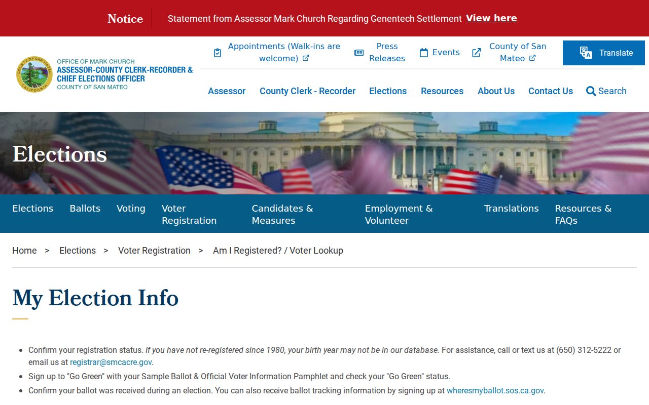
Use voter information only through the channel and purpose the election authority permits, then keep the result separate from deed and directory evidence.
South San Francisco Street Directory Limits
A street directory can show parcels, title parties, dated project activity, or historical listings. It cannot reveal every occupant, a private utility account, a DMV address, school-student information, delivery data, or a protected Safe at Home address. Ownership is not occupancy. A trust or entity can appear in a deed without naming an individual beneficiary, and an old directory can omit an entire household.
Lawful personal use. Address and parcel records support property history, genealogy, civic research, reconnecting, and scam checks. Using a South San Francisco street directory to follow, threaten, intimidate, publish protected details, or harass a person is prohibited and may violate California law.
When the goal shifts from a whole street to one person, compare two independent identity fields and use the responsible custodian for a correction. A street-by-street record trail should end with a verified source, not a guess about who is behind a door.
The county parcel workflow remains the best route for the full street chain; the South San Francisco resident lookup route handles a single-name verification question.